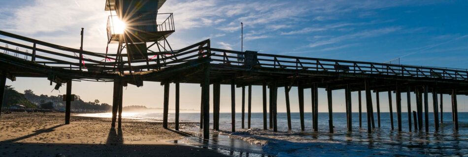
Tahoe Light Photography » Corporate, outdoor and adventure photography by Reno and Lake Tahoe freelance photographer Scott Sady.

Masthead header

Alabama Hills and Eureka Dunes landscape photography

by Scott Sady

Monique and I set off Sunday in search of fall colors. We knew that the aspens were looking good around South Lake and Sabrina Lake near Bishop, but when we got down there, we found a brief storm a few days ago had frozen the turning leaves and made them go an ugly black. Nothing to see here as the old saying goes, so we spontaneously changed our plans to backpack in this area shooting fall colors and decided to head another hour south to the Alabama Hills, always a cool place. We figured in the middle of the week in October, nobody would be there. Boy were we wrong. Take note, it just happened to be Columbus Day weekend (does he still merit a holiday?) which is the same weekend that Lone Pine was hosting it’s 22nd annual Lone Pine Film Festival.

Despite the much higher than usual campers in the area, we were still able to find nice secluded areas to camp in solitude as well as shoot undisturbed sunrise and sunset shots. The only thing I didn’t feel like doing was hanging with the 10 other photographers in the area, who all congregated around the one well known arch all day long. There is only one marked hiking trail in the Alabama Hills that I know of, it starts at an obvious turnout off the main road (Movie Rd.) and has signs directing people to “the arch.” Well, we went exploring for hours among the coolest rocks in the world and found a couple of arches of our own with not a sole around. Funny thing is, I didn’t realize there was a “The Arch” here, so at one point a photographer rolls into our campsite and asks if I knew how to get to “The Arch,” I gave him some really difficult directions involving some route finding and a lot of hiking to get to an arch that I liked. The next day I drove by “The Arch” turnout. I hope he didn’t listen to me, because if he did, I’m sure he must think I am out of my mind.

This was the trip when I finally decided that I am done with split grade neutral density filters. Sacrilege you say? I have been using high-end Singh Ray filters for a decade. But after getting home and playing with what Photoshop can do now with smart object stacking (stacking multiple raw images in a way that not only allows you to access the Camera Raw features for each image in the stack at any given time, but also allows you to mask and blend however you want) I just convinced myself that I can get better quality by bracketing a few raw exposures and stacking them as smart objects and blending with gradient masks as well as painting specific masks where I want them.

I also did away with another relic of my film days on this trip, the long time exposures. Digital has always had it’s limitations with long night exposures such as those found in star trail shots. Once again I finally proved to myself that stacking multiple, shorter exposures, then blending them via the maximum mode produces a higher-quality star trail image and allows me more control.

One last little experiment we did on this trip was with a converted infrared camera. I had a Nikon D300 converted to photograph only in the infrared spectrum in Black and White which we had used for a cool effect in our wedding photography. This was the first time I had it out for strictly landscape use, and it did not disappoint! I used that probably more than our color body. We had a full moon during our trip, so many of these images were actually taken at night, but on a long exposure under a full moon, it just looks like a daylight shot….with stars.

All of these images, and many more are available for license or for sale as prints, just search my archive using keywords such as Alabama Hills, etc.


star trails over mt whitney

Star trails over Mt. Whitney and Lone Pine peak in the Alabama Hills. This was done via stacking method.

sunrise over alabama hills

Sunrise on Lone Pine Peak from Alabama Hills. You may recognize this exact scene (only in mid-day) as the Jerico Missile test site from the original Iron Man movie.


infrared landscape

Sunrise in the High Sierra from Alabama Hills

infrared landscape

Lone Pine peak viewed through the rocks of Alabama Hills.

infrared lanscape

Sunrise on the High Sierra seen through one of the many small arches in the Alabama Hills.

lanscape photography

Mt. Whitney framed in one of the many arches in the Alabama Hills in this infra-red shot.

Monique walking down Movie Road.

Full moon rise.

tent and landscape photo

Our wonderful Big Agnes Fly Creek tent with Lone Pine peak in this 30 second night exposure.

sunrise from alabama hills landscape

Sunrise on Mt. Whitney from the Alabama Hills.

vertical sunrise in high sierra

One final shot from the Alabama Hills sunrise.

infrared lanscape in Eureka Dunes

An infra-red shot at the base of Eureka Dunes.

Eureka Dunes infrared

Me hiking up to try and catch a shot with the last light, but I was too late.

Eureka Dunes abstract landscape

Last light on the Eureka Dunes.

Eureka Dunes infrared landscape

long exposure on the eureka dunes

Even from the top of the Eureka Dunes, we found people. This long night exposure shows the approach of another hiker along the ridgeline.

woman on sand dunes at night

Monique holds still for this 30 second night exposure at the top of the Eureka Dunes in Death Valley.

night abstract landscape on sand dunes

Eureka Dunes exposure under full moon.

Eureka Dunes landscape

Eureka Dunes sunrise infrared photograph.


October 18, 2011 - 11:23 am

Barrett Donovan - Taylor (my brother) sent me the link to your blog. Awesome images Scott! Definitely a productive trip. Great post too, interesting about the GND filters.

Sawtooth range High Sierra backpacking cross country routes

Our campsite in the meadow below Return Lake, looking across at Excelsior Mountain and Shepherd Crest at sunset. The meadow made much better camping than Return Lake as it had more flat spots, lots of running water and less mosquitoes.

by Scott Sady

Day 1: Green Lakes trail head over Virginia Pass. Our first day started easily enough at Green lakes trail-head. Starting elevation was 7800 feet. We followed the trail to Green Lakes, then cross country to Virginia pass at 10550 ft. There was a decent use trail up to the pass and down the back side. Shortly after starting down the back, we then cut due west cross country to camp in a meadow below return lake and Virginia Peak.

Day 2: Stanton Pass to Spiller Creek. From the meadow just below Return Lake, which had beautiful running streams and far less mosquitoes and more flat area than Return Lake, we proceeded to the pass between Virginia Peak and Stanton Peak.
The book describes this as class 3 but it is actually a very hard class three. The low point or true saddle is not what you must aim for as we found out having to downclimb and aim for a higher point as far climber’s right as you can get, just left of a large peaklet that marks the start of Virginia Peak.
The Down-climb into the canyon is treacherous over steep and endless scree fields. We were destroyed by the end of the day and camped in the first semi-flat place we could find above the meadows.

Day 3: Spiller Creek Canyon. From a high meadow just below Virginia Peak we made our way on tired legs slowly down into Spiller Creek Canyon. After a short decent of a few hundred feet we hit treeline. The forest quickly closed in about us but opened up in front of us making for easy traveling. Bear scat was everywhere and wildflowers painted the forest floor with every imaginable color. From our nights perch just below the snowfield that formed the headwaters of Spiller Creek, we eventually came to the creek itself. We followed the water downstream staying on the north east side as the terrain alternated between open forest and meadows crisscrossed by snowmelt streams at regular intervals. Every now and then we would get a stark reminder of natures awesome power in the form of massive avalanche paths. The kind that only happen every hundred years or so. Abruptly the forest would end on a sometimes 1/4 mile long swath stripped clear of topsoil and piled high with the skeletons of massive downed trees.
Finally, about a 1/4 mile before we were to reach the junction of the PCT, the forest and meadows gave way to smooth, clean granite. The river cascaded along a granite bed, occasionally turning and slowing enough to form crystal clear and ice cold pools deep enough to swim in. We pitched our tents among the trees back from the waters edge, settled in and took a much needed swim in the icy waters.

Day 4: Spiller Creek to Hoover Lakes. We made Virginia Canyon along return creek in fast time. Nothing much to see until you begin to climb the 900 feet up to Summit Lake. Near the top of the climb is the most spectacular wildflower field I have ever seen with views out towards Virginia Peak and Stanton Peak, the pass we did on our second day.
Summit lake is a beautiful lake with camping space at both ends. We stayed at Hoover lakes surrounded by marmots and mouthy birds. The only camping we could find there was between the two lakes. From Hoover lake we stared up at the backside of Dunderberg peak, which I have skied in winter.
The valley you drop into following the trail past summit lake is straight out of a fantasy movie. High glaciers feed three separate streams that cascade nearly a thousand vertical feet before joining at the valley floor and rushing away. One of the streams springs out from a football sized hole in the very mountain itself. I made the climb up to the surging spring and drank the best tasting water straight from the mouth of the mountain.

Day 5: Hoover Lakes back to trail-head. The final day was a fairly non-eventful hike downhill back to the trail-head. The only real camping along this area is at East Lake, large with good swimming, and Green Lake, which has at least two really built up camp-sites, complete with giant cut benches made out of downed trees, and massive fire-pits. Though since Green Lake is only a few miles from the trail-head, you will have company.

All these images and more are available for sale or license at my stock image archive. Also see our trip report from the Ansel Adams wilderness and Minaretes last year.

picture of high sierra

Reaching Green Lake after a 2.5 mile hike from the trail-head, and looking across at the cross-country route we had selected to start our trip across the Sawthooth's.

Heading up Virginia Pass after leaving the trail at Green Lakes. There is a subtle, but decent use trail that goes to the top of the pass, and I would consider this a fairly easy climb up to 10,550ft.

Our route up Virginia Pass after leaving the trail at Green Lakes. There is a subtle, but decent use trail that goes to the top of the pass, and I would consider this a fairly easy climb up to 10,550ft.

On top of Virginia Pass at 10,550 ft. Looking across at Stanton Peak and Stanton Pass, which we will hit the next day.

Our campsite in the meadow below Return Lake, looking across at Excelsior Mountain and Shepherd Crest at sunset. The meadow made much better camping than Return Lake as it had more flat spots, lots of running water and less mosquitoes.

On top of Stanton Pass after two attempts. We aimed for the low spot in the saddle, but it was all cliffs on the other side. Then we scouted and found a steep gully route near the base of Virginia Peak. The book The High Sierra by R.J. Secor describes a ledge ascent that leads to a notch on the ridge below Stanton peak, but as it was covered in snow on the approach, we don't know if this was easier or not. This was a very difficult pass with hands and feet scrambling on loose talus. We had to take the girls packs for them to make it.

The back side of Stanton Pass into Spiller Creek canon after two attempts. This was a long and steep talus downclimb.

Heading down into the untouched headwaters of Spiller Creek with our objective for the next day, Matterhorn Pass, visible as the low saddle at top right.

Camp for the night in Spiller Creek. After much discussion of our depleted physical state after Stanton Pass, and the possibility that Matterhorn Pass would be just as hard, though only a class 2 downclimb after a class 3 ascent, we decided to head down Spiller Creek and hook up with the PCT.

Heading through amazing fields of wildflowers down into Spiller Creek canyon.

Spiller Creek canyon was a true gem. No trails, no sign of humanity and we never saw either a person or a hint of a campsite. Here we take a lunch break in a massive avalanche path. Note all the trees strewn about like twigs.

Heading through amazing fields of wildflowers in Spiller Creek canyon. The canyon was untouched by humanity and very easy to navigate.

Heading through amazing fields of wildflowers in Spiller Creek canyon. The canyon was untouched by humanity and very easy to navigate.

Pumping water on a beautiful flat slab of granite along Spiller Creek. Up to this point there were no trails and no signs of human presence in the entire canyon. We felt like it was ours alone. This campsite rates among the best I ever had.

Finally came to a rest about 1/4 mile before reaching the PCT on a beautiful flat slab of granite along Spiller Creek. Up to this point there were no trails and no signs of human presence in the entire canyon. We felt like it was ours alone. This campsite rates among the best I ever had. Loads of flat, clean granite to stretch out on, play games, do yoga, and an exceptional swimming hole if you explore up-river.

One of the may species of wildflowers that literally littered the entire canyon floor, was wild onion. So we picked a few for dinner to season up our lentle and rice mix. MMmmmm!

A night exposure by the full moon near our campsite along Spiller Creek.

Finally came to a rest about 1/4 mile before reaching the PCT on a beautiful flat slab of granite along Spiller Creek. Up to this point there were no trails and no signs of human presence in the entire canyon. We felt like it was ours alone. This campsite rates among the best I ever had. Loads of flat, clean granite to stretch out on, play games, do yoga, and an exceptional swimming hole if you explore up-river.

After recouping our strength from the difficult climb up Stanton Pass, we changed our original plans and looped back towards our starting point at Green Lake. We followed Virginia Canyon back uphill, paralleling Spiller Creek Canyon, though this time on a trail. Here we are with a brave young buck just about to ascend out of the canyon to Summit Lake.

Most of Virginia Canyon was an easy, but underwhelming hike on a well used trail. But the last 1/4 mile before reaching Summit Lake revealed the best wildflower fields I have ever seen.

Most of Virginia canyon was an easy, but underwhelming hike on a well used trail. But the last 1/4 mile before reaching Summit Lake revealed the best wildflower fields I have ever seen. Here we are looking back at Stanton and Virginia peaks and the pass between them that we climbed 2 days prior.Most of Virginia canyon was an easy, but underwhelming hike on a well used trail. But the last 1/4 mile before reaching Summit lake revealed the best wildflower fields I have ever seen. Here we are looking back at Stanton and Virginia peaks and the pass between them that we climbed 2 days prior.

Summit Lake and back out of Yosemite National Park and into the Hoover Wilderness again.

A Yosemite park boundary marker from 1906.

Our trial and error route up Stanton Pass. The yellow line is the line we think is described in very little detail in The High Sierra by R.J.Secor. But we could not find a viable approach, possibly due to snow. The Red route is our initial climb. Class 3, fairly straight-forward, but closed out on the descent by cliffs. The green route up the steep gully below the edge of Virginia Peak ended up being our route. We had to go back down a third time and get the girls packs for them to make it. Class 3 on both sides, hands and feet mandatory on the ascent.

Our campsite at Hoover Lakes. Not much of a choice, but nice for us, and not a soul in sight.

The way down from Summit Lake to Green lake was marked by numerous stream crossings. Some pretty stout. Springtime in August. You gotta love it.

August 19, 2011 - 10:03 pm

Nanette Barber - Great pictures! I feel like I was there…minus all the hard work of course.